Laser Scanning Services
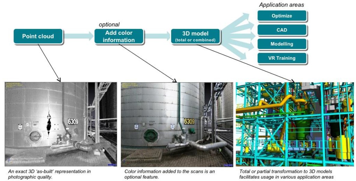
Laser scanning has been proven to be an effective method for capturing detailed 3D spatial data in order to create 3D as-built models. As-built surveys using 3D laser scanning technology provides construction user with detailed point clouds which enable 3D modeling for diverse tasks including building reconstruction, plant layout and as-built drawings generation. CCT International provides several Laser Scanning services and has worked with sites in various countries including Oman, United Arab Emirates and Kazakhstan. Typical Project Deliverables:The result of a scan acquisition is a huge number of points in space, each having an x, y, z coordinate. CCT takes this raw data, to produce detailed 3D models provided in various CAD formats including AutoCAD, SP 3D, etc. Since CCT is also a specialist in BIM, we provide further detailing services to allow and upgrade the points we scan for full BIM use. This process uses extensive and specialized know-how which not only scans the sites, but also cleans the scanned points, aligns the scanning stations, sets coordinates and geo-references, and delivers the combined point cloud model in the required format. In as-built situations, we provide customers with survey reports outlining the conditions of sites.
Other applications of Laser scanning:•CONSTRUCTION - QUALITY INSPECTION
•INDUSTRIAL 3D MODELLING
•GENERAL INFRASTRUCTURE (ROADS – AIRPORTS
– TUNNELING)
•EARTHWORKS & MINING
|